RBI Sign In
Regions
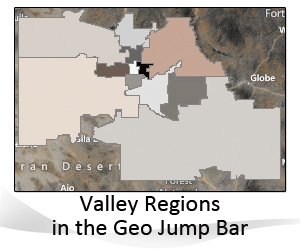
Normally, markets are analyzed in a hierarchy of geographic divisions, such as County, City and ZIP Code. The Valley is distinct in that the largest amount of its real property is located in one county, Maricopa, with a secondary county, Pinal, accounting for the remainder. This renders any county differentiation too broad to detect differences in significant parts of the Valley. Subscribers often describe their real estate activity regionally, such as the Northwest Valley or the Southeast Valley, without any clear guidelines as to where that part of the Valley begins or ends.
By dividing the Valley in Regions with specific, unique ZIP Codes, Subscribers now have the ability to analyze and monitor regional market activity. For example, for the Subscriber, who might be advising an investor or someone new to the Valley with no knowledge of where to relocate, a Regional approach allows the Subscriber to better explain the nuances of living in one part of the Valley over another. It also makes it possible to analysis the effects on a regional market of a major economic event, that would be significant to one area and have no effect on another.
There are twelve Valley Regions, which include a Pinal Region. ZIP Codes in Pinal County that are in close geographic proximity to the Valley, such as the ZIP Codes for Apache Junction and Gold Canyon, have been assigned to the Far Southeast Valley.
Central Phoenix
Central Valley
North Phoenix
North Valley
Northeast Valley
Northwest Valley
South Valley
South East Valley
Far Southeast Valley
Southwest Valley
West Valley
Pinal Region
When you select a specific Region on the Geo Jump Bar, the cities associated with that Region will appear as hyperlinks. You will notice faint lines on the Region maps, these indicate ZIP Code boundaries. In some cases, the irregular shape of a Region is caused by the shape of an actual Zip Code(s) that make up the Region.
Cities, however, can straddle Regions. For analysis, where Regions are not appropriate, Subscribers can analyze the market by City or ZIP Code.
Click here to learn more about Navigation Highlights and Tips.